Winter Storm Fern brings dangerous conditions to millions
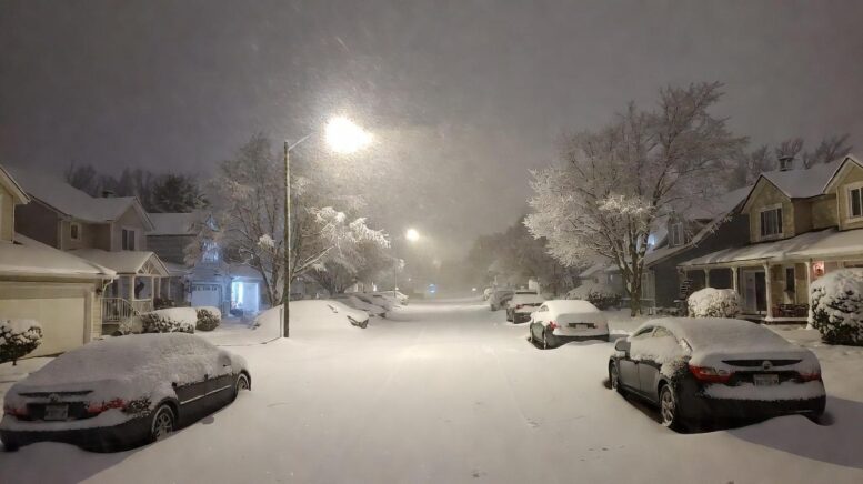
*A massive winter storm—dubbed by some forecasters as Winter Storm Fern—is blasting its way across the central and eastern United States, bringing dangerous ice, heavy snow, and freezing rain to over 230 million people. Spanning more than 2,000 miles, the storm stretches from the Southern Plains to New England, making it one of the most widespread winter weather events in recent years.
The National Weather Service has issued alerts in at least 30 states, with governors in more than a dozen declaring states of emergency. Travel is hazardous, power outages are rising, and life-threatening cold is pushing wind chills well below zero in many regions.
12 cities expected to be hardest hit by Winter Storm Fern
Meteorologists have identified the following cities as being in the storm’s direct path, with the highest risk for snow, ice, and disruption:
- Oklahoma City: Heavy snow and sleet with 6–10+ inches possible; major impact (9/10)
- Dallas/Fort Worth: 0.25–0.75 inches of ice, freezing rain, and Arctic air
- Little Rock, AR: Ice storm conditions, 1–3 inches of snow and 0.50 inches of ice
- Tupelo, MS: Potential catastrophic ice storm; up to 10/10 impact rating
- Nashville, TN: 2–4 inches of snow, followed by 0.50 inches of ice
- Cincinnati, OH: Up to 12+ inches of snow; major travel impacts
- Pittsburgh, PA: Heavy snow and bitter cold; 9/10 impact
- Memphis, TN: 1–3 inches of snow with ice risks; slick and dangerous roads
- Charlotte, NC: 0.50–0.75 inches of ice; high risk for outages and blocked roads
- Atlanta (northern suburbs): Freezing rain and sleet with black ice concerns
- Washington, D.C.: Transition from rain to heavy snow; several inches possible
- Raleigh, NC: Icy mix creating treacherous conditions and power risks
Conditions will vary by region, but most areas face dangerous travel, school closures, flight cancellations, and utility disruptions due to heavy ice and snow loads on infrastructure.
Scroll to continue reading


Widespread alerts, states of emergency, and power risks
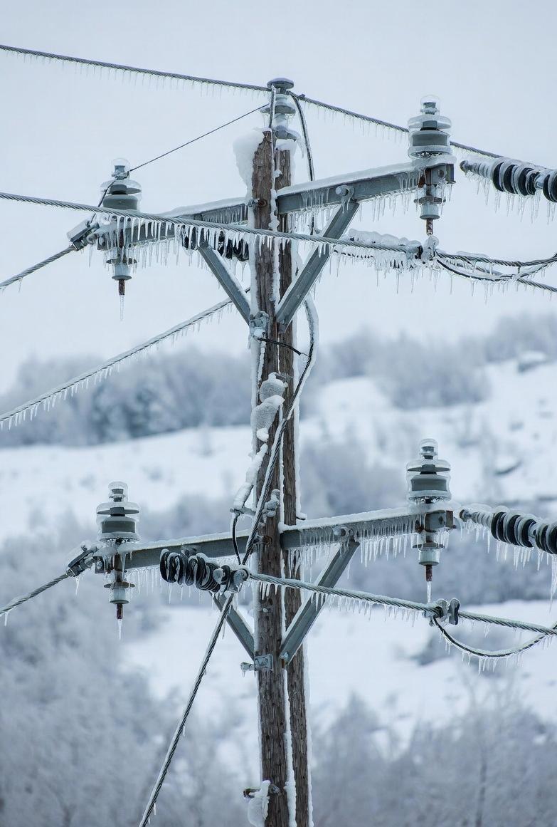
As of Friday, power outages have already begun in parts of Texas, Arkansas, and the Mid-South. The greatest threats stem from ice accumulation on power lines and tree limbs, which can cause prolonged blackouts as crews struggle to access roads.
Flight delays and cancellations are escalating, with Dallas-Fort Worth and Memphis airports among the hardest hit. Road conditions in cities like Charlotte, Little Rock, and Nashville are being described as “near impassable.”
Stay prepared and monitor real-time alerts
Officials urge residents in affected zones to stay indoors, avoid unnecessary travel, and check on elderly neighbors or those without reliable heating. Prepare for potential outages by charging devices, gathering extra food and water, and layering up for warmth.
- Use official sources like weather.gov or local news for the latest forecast updates
- Download weather apps such as Weather Underground or AccuWeather for city-specific alerts
- Avoid driving in icy conditions unless absolutely necessary
The storm’s worst is expected to unfold from Friday through Sunday as it tracks northeast. Even as snowfall ends in some areas, extreme cold and ice risks may linger into early next week.
Why Winter Storm Fern is a serious threat
This system is not just another winter inconvenience. With high snow totals, crippling ice accumulation, and brutal cold following close behind, Winter Storm Fern could impact millions for days. Emergency officials are urging early action to stay safe as conditions worsen across the country.
Check in with your local emergency services and plan for delays, closures, and the potential loss of power or heat. Safety is the top priority as this historic storm unfolds.
(If You Like/Appreciate This EURweb Story, Please SHARE it!)
MORE NEWS ON EURWEB.COM: Zoom Launches ‘Solopreneur 50’ to Support Independent Entrepreneurs | VIDEO
We Publish Breaking News 24/7. Don’t Miss Out! Sign up for our Free daily newsletter HERE.